Stake attention in this memory
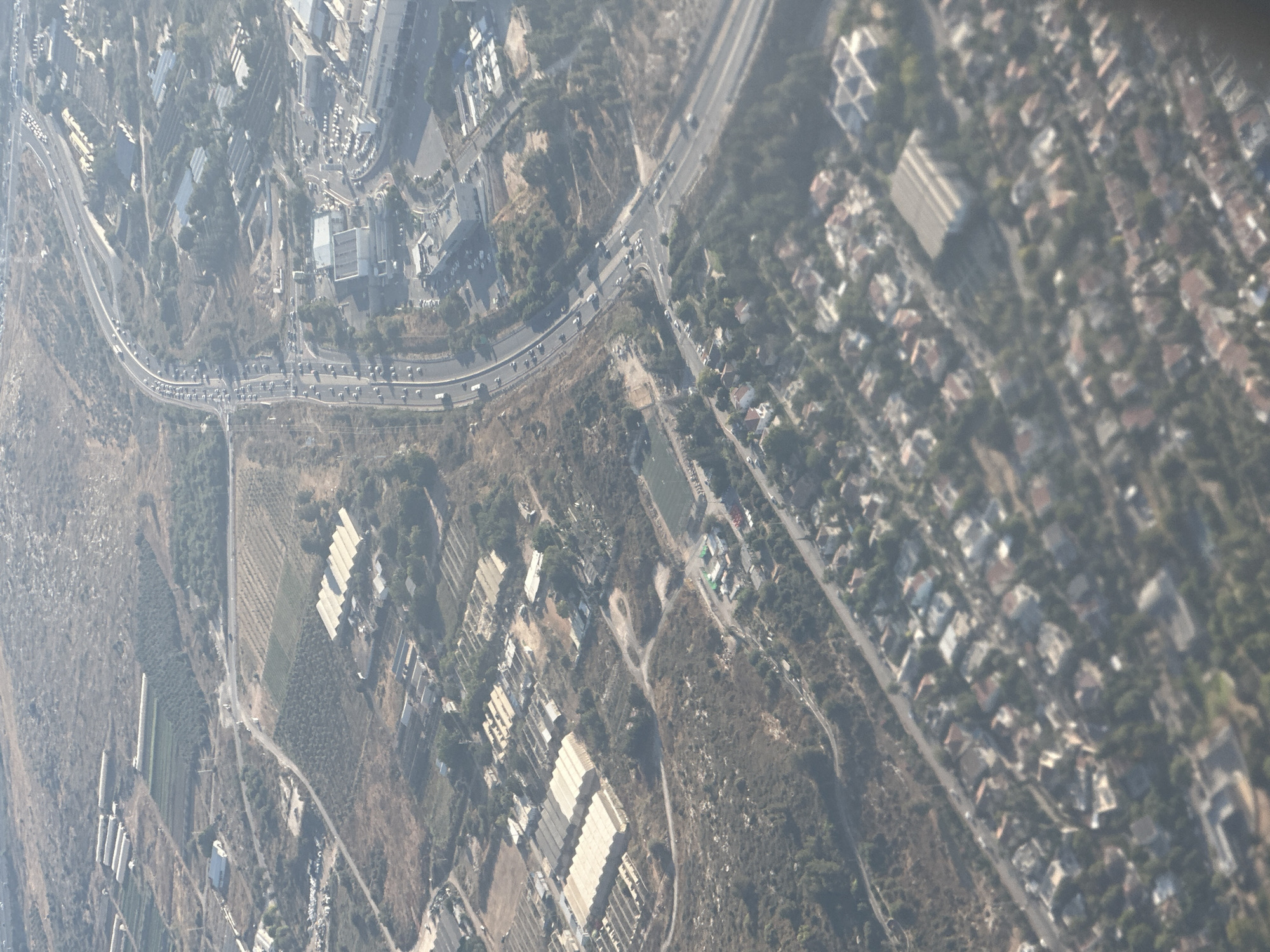
This aerial photograph captures a sprawling urban and semi-urban landscape. The scene is dominated by roads, buildings of various sizes and architectural styles, and patches of vegetation. The perspective is from a high vantage point, likely an aircraft, looking down at a tilted angle. The subjects are primarily man-made structures and infrastructure. We see a highway with multiple lanes of traffic, indicating significant transportation activity. Alongside the highway, there are residential areas with densely packed houses, many featuring red-tiled roofs, suggesting a developed neighborhood. Further away, there are larger industrial or institutional buildings with flat roofs, some appearing to be warehouses or factories. The presence of agricultural fields, characterized by neat rows of crops or greenhouses, suggests a mix of urban and rural land use. Numerous cars are visible on the roads and in parking areas, implying a daytime scene. The weather appears to be clear, with good visibility, allowing for a detailed view of the terrain and structures. The sunlight casts shadows, though they are not particularly pronounced, suggesting it is not early morning or late afternoon. The overall impression is one of a functional and populated area, with daily life in progress. No specific event is clearly discernible, but the general activity suggests a normal day. Location cues, such as the style of buildings and the layout of the urban areas, combined with the provided location context of Modi'in Illit, suggest this is likely a settlement in the Palestinian Territories. There is no visible text in the image.
No transactions found