Stake attention in this memory
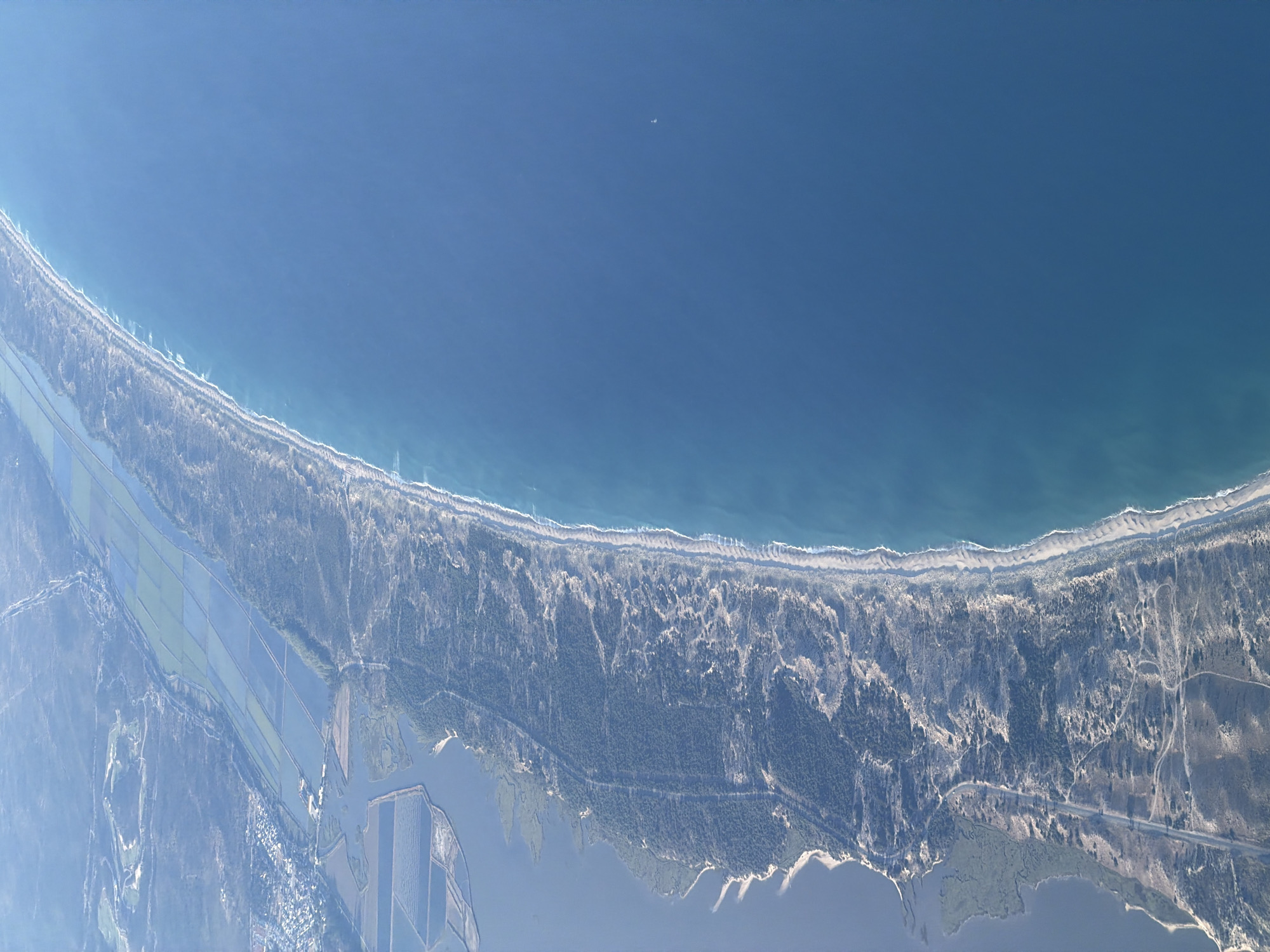
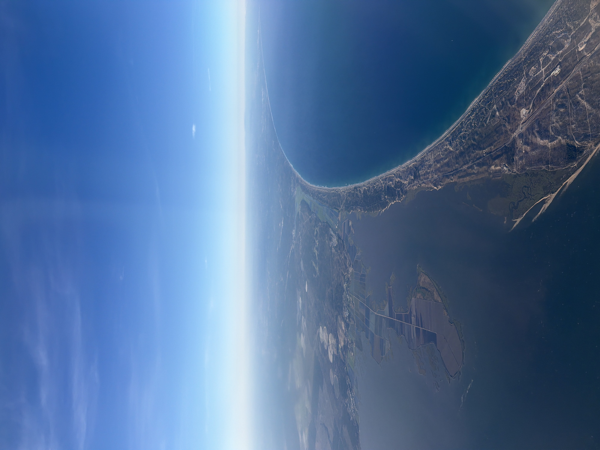
This high-altitude aerial image captures a sweeping view of a coastline under a clear, bright blue sky. The curved horizon suggests a wide-angle perspective from a significant elevation. The sky transitions from a deep blue overhead to a lighter, hazy blue-white closer to the horizon, indicating atmospheric depth. The main geographical features include a vast expanse of deep blue ocean on one side, meeting a long, narrow sandy coastline. This coastal strip appears to be a peninsula or sand spit, separating the open ocean from a large, calmer body of water, likely an estuary or lagoon, on the landward side. Along the coastline, patches of vegetation, possibly dunes and low-lying forests, are visible, interspersed with signs of human development like roads and scattered buildings. Further inland, the landscape reveals a mix of forested areas, cleared land, and agricultural fields. Distinctive circular irrigation patterns can be observed in some of the cultivated areas, indicating farming activity. Other structures and linear features, such as roads, crisscross the terrain. The overall lighting suggests it is daytime, under clear weather conditions. There are no people, explicit activities, or visible text in the image. The coastal morphology and agricultural patterns are consistent with the region of Grândola, Portugal.
No transactions found