Stake attention in this memory
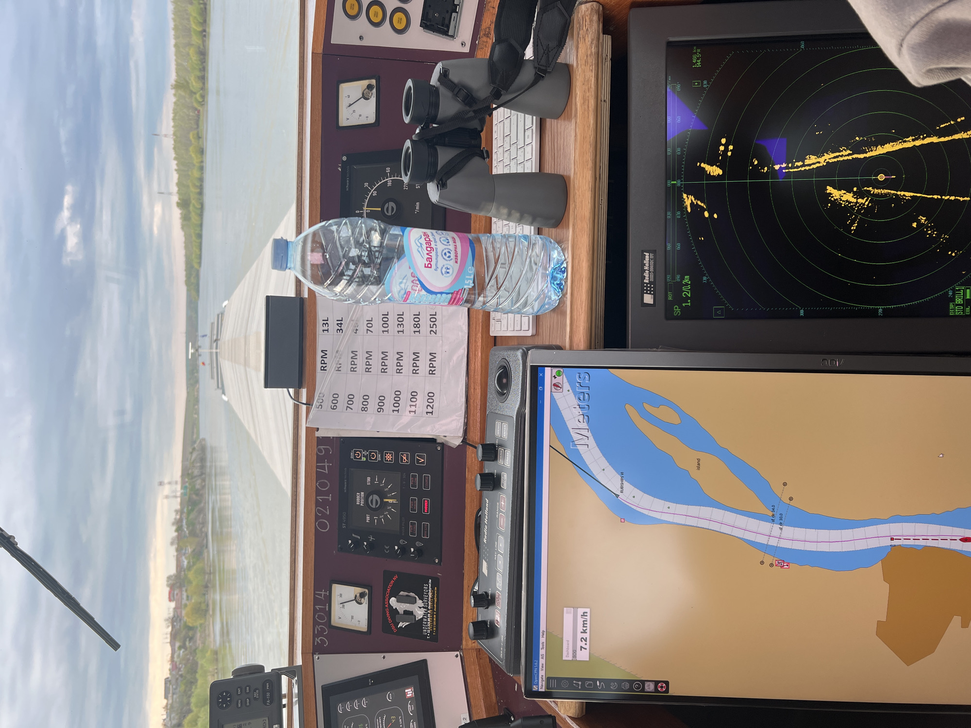
The image provides a detailed view from the navigation bridge of a boat, looking out over a wide river. The vessel appears to be actively underway, with instruments indicating navigation in progress during daytime under a partly cloudy sky. The location context of Ghindărești, Romania, places this scene on a major river, likely the Danube. Through the window, calm river water stretches towards distant banks lined with trees. A wiper blade is visible in the lower-left corner of the exterior view. Inside the helm, numerous objects and control systems are visible. A radar screen (Radio Holland) on the right displays yellow contacts and a blue track, indicating a range of "1.2/0.2km". Below it, a chart plotter running OpenCPN 5.6.2 shows a detailed map of a river with an "Island" and depth soundings like "sf dr 30.0" and "sf dr 34.0". The boat's current speed of "7.2 km/h" and a tracked path labeled "RUBISHIPS VI" are visible on this display. On the wooden console, a pair of grey binoculars with a black strap is placed next to a plastic water bottle with a blue cap. The bottle's label reads "Балдаран ИЗВОРНА ВОДА 1.5Le" (Baldaran Source Water 1.5L). Various control panels and gauges are mounted on the console. These include a rudder position indicator (ST-4950) marked with "RUDDER POSITION", "PORT", and "STBD", as well as analog gauges for "V" (voltage) and RPM. A paper note lists engine RPMs from "500 RPM" to "1200 RPM" with corresponding fuel consumption figures ranging from "13L" to "250L". Other visible text includes "FA-150 PWR", "33014", "021049", "Radio Holland" on a control unit, and a sticker for "DSU DIVING ASSOCIATION NV UNDERWATER SURVEYORS".
Symbol
6727A
Volume
2,855
Creator
+$0.02
Revenue
+$0.00
TVL
$1.80
More from this user
More from Ghindărești