Stake attention in this memory
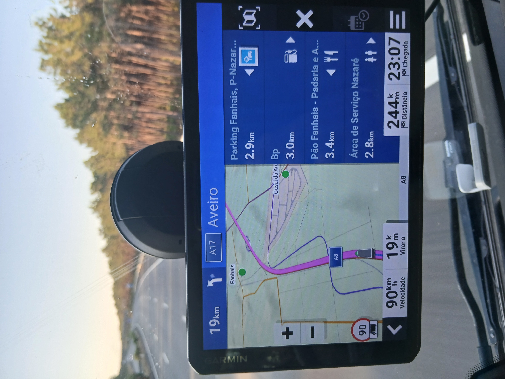
This is a close-up, eye-level, forward-facing shot of a Garmin GPS device mounted on the dashboard of a vehicle, likely a truck due to the "90" speed limit sign with a truck symbol. The GPS displays a map of the road network, indicating the current location and upcoming points of interest. The route shown on the GPS is on the A17, heading towards Aveiro. A specific point of interest, "Fanhais", is marked with a green circle on the map. The GPS screen also lists several upcoming points of interest: "Parking Fanhais, P-Nazaré..." at 2.9km, "Bp" (likely a gas station) at 3.0km, "Pão Fanhais - Padaria e A..." (bread shop and more) at 3.4km, and "Área de Serviço Nazaré" (Nazaré Service Area) at 2.8km. The vehicle's current speed is displayed as 90 km/h, and the distance to the next turn is 19 km. The estimated time of arrival is 23:07, with 244 km remaining. The scene is set during daylight, with the sun casting a warm glow through the windshield, illuminating the GPS screen. The background outside the vehicle shows a road winding through a forested area, characteristic of Portugal. The GPS device itself is black, with a touchscreen interface. The overall impression is of a driver navigating a journey.
Symbol
306D1
Volume
11,550
Creator
+$0.25
Revenue
+$0.00
TVL
$24.76
More from this user
More from Valado dos Frades