Stake attention in this memory
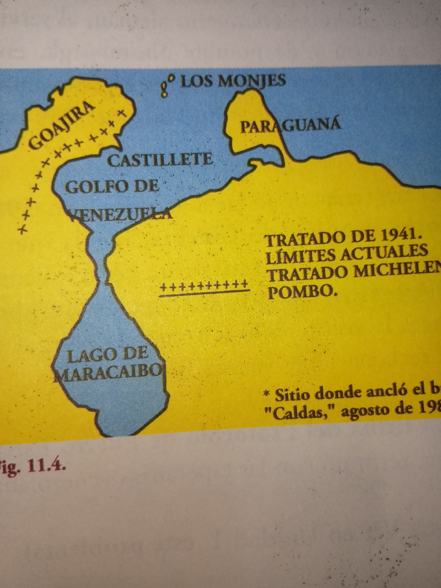
The image is a scanned page from a book, featuring a map of a border region in South America, likely related to historical treaties. At the top left, a circular badge displays the number "208". Below this, a header reads "extensos territorios; ese documento fue firmado". The main content is a map with geographical features like rivers and coastlines, labeled in Spanish. The map title, "TRAZADO DE LA LÍNEA FIJADA POR EL TRATADO POMBO-MICHELENA 1833", indicates a border line established by a treaty. Key geographical names visible include "MAR CARIBE", "CABO LA VELLA", "CABO CHICHIVACOA", "ISLA DE MARGARITA", "SIERRA DE PERIJÁ", "LAGO DE MARACAIBO", "COLOMBIA", "VENEZUELA", "RIO CATATUMBO", "RIO APURE", "RIO ORINOCO", "RIO ARAUCA", "RIO CASANARE", "RIO META", "RIO VICHADA", "RIO GUAVIARE", "RIO GUANIA", "RIO APAPORIS", "RIO NEGRO", "BRASIL", "RIO YARUPÁ", "ECUADOR", "RIO CAQUETA", "RIO PUTUMAYO", and "RIO AMAZONAS". A dotted red line represents "LA DEMARCACIÓN VIGENTE". The bottom of the image shows "Fig. 11.3.". There are no people or actions depicted in the map itself. The surrounding page shows a textured background, likely from the book's binding or paper. The city of Guayacán, Venezuela is not explicitly located or referenced on the map.
No transactions found