Stake attention in this memory
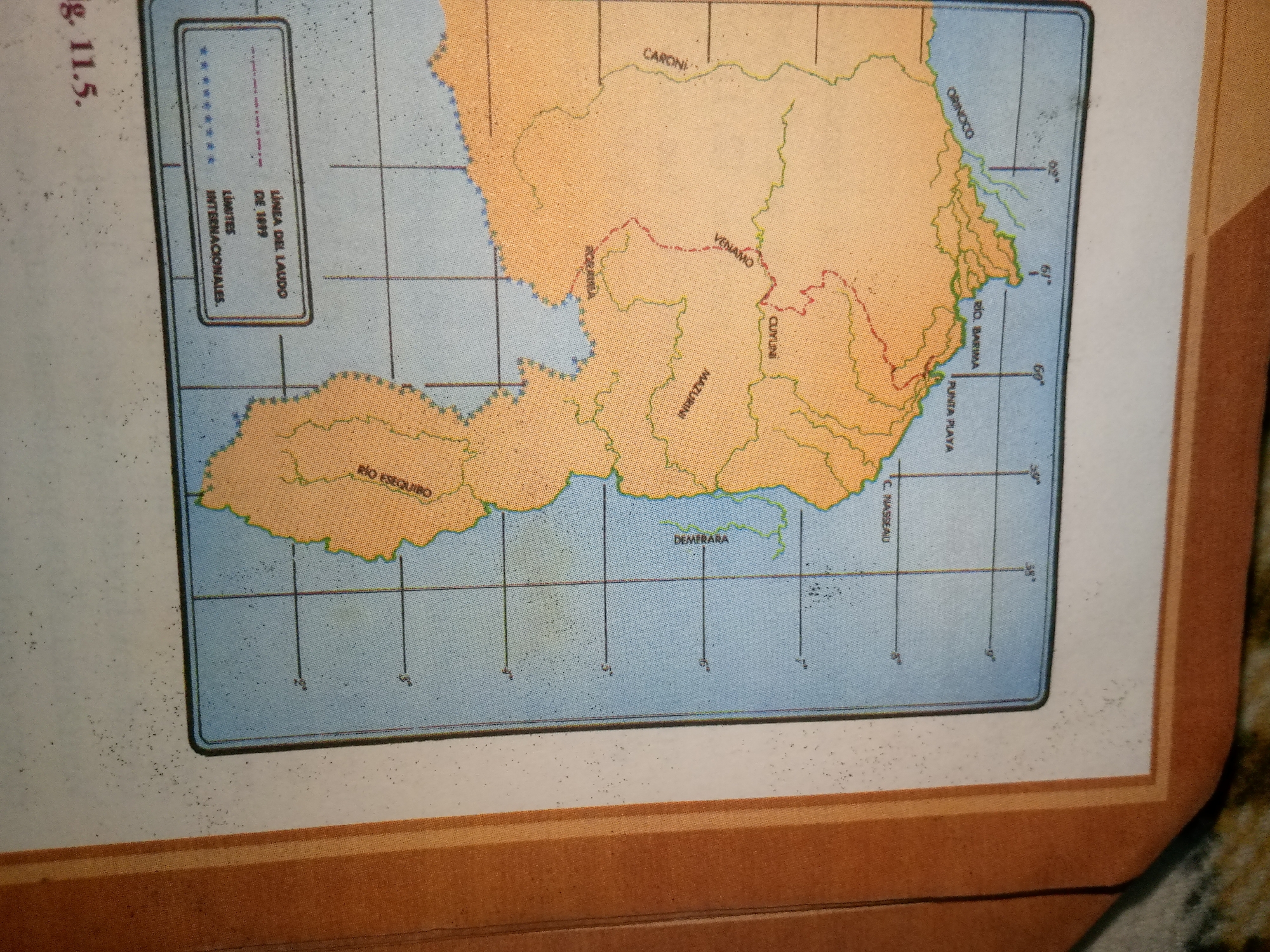
The image is a map of a region in South America, featuring a section of the coastline and inland territories. The map displays geographical features such as rivers (e.g., ORINOCO, RIO BARIMA, RIO ESEQUIBO, DEMERARA) and place names (e.g., CARONI, VENAMO, CURUNI, MAZARUNI, C. NASSAU, PUNTA PLAYA). A key in the upper left corner indicates "LINEA DEL LAUDO DE 1899," "LIMITES INTERNACIONALES," and features a dotted line symbol, likely representing an international border or a demarcation line from 1899. The map is bordered by a grid of latitude and longitude lines, with markings like 62°, 61°, 60°, 59°, and 4°, 3°, 2°, 1°. The land areas are colored in shades of orange and yellow, while bodies of water are depicted in blue. The map is situated within a larger context, with a white border and a section of a brown cover or folder visible at the bottom and right edges. The top left corner also shows part of a page with text that reads "g. 11.5.". The overall image is a map illustration with textual labels and geographical representations.
No transactions found