
Sign in
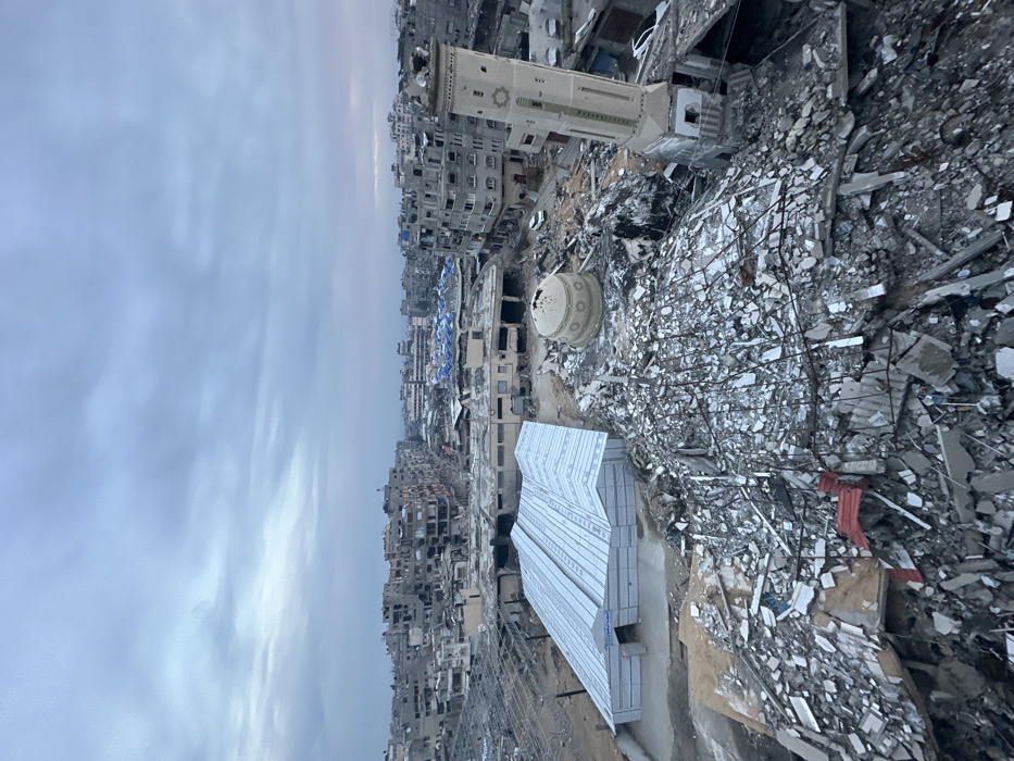
The image shows a scene of destruction in Gaza City. The location is at 31.535 latitude and 34.465 longitude. The image was taken from an aerial perspective. The scene is dominated by rubble, debris, and destroyed buildings. A partially destroyed mosque, with a dome visible, sits in the middle of the rubble field. A large, white, rectangular structure, possibly a prefabricated building, sits to the right of the mosque.  The background shows a cityscape of damaged buildings. The sky is cloudy, and the sun is setting in the distance. There are no people visible in the image.
HASAN

Mar 3, 2025, 3:42 PM

Gaza

Stake attention in this memory

destruction
devastation
war
sadness
loss

The image shows a scene of destruction in Gaza City. The location is at 31.535 latitude and 34.465 longitude. The image was taken from an aerial perspective. The scene is dominated by rubble, debris, and destroyed buildings. A partially destroyed mosque, with a dome visible, sits in the middle of the rubble field. A large, white, rectangular structure, possibly a prefabricated building, sits to the right of the mosque. The background shows a cityscape of damaged buildings. The sky is cloudy, and the sun is setting in the distance. There are no people visible in the image.

Loading AttnAds…

transactions
revenues
stakers
Earliest
Latest
Highest stake

No transactions found
More from this user

More from Gaza

Nearby

this memory

nearby events

HASAN

Mar 3, 2025, 3:42 PM

Gaza

Licensed under Creative Commons Attribution 4.0 International License. You are free to share and adapt this content with proper attribution.