Stake attention in this memory
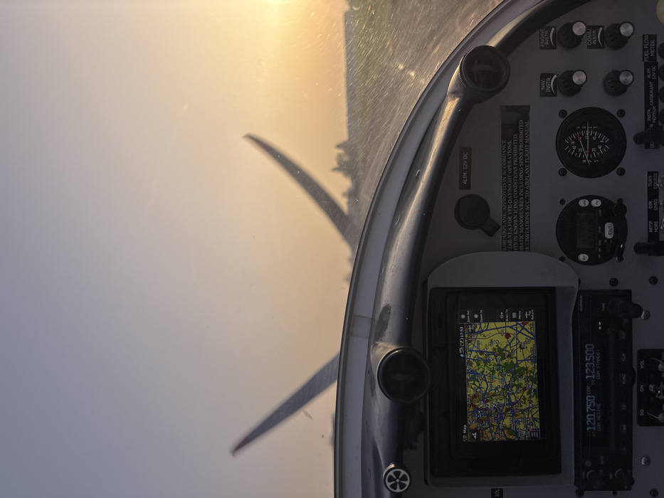
The image depicts a forensic view from inside the cockpit of a light aircraft at Toussus-le-Noble Airport (LFPN), France, during either sunrise or sunset. The lower half of the frame shows the aircraft's instrument panel. On the left, a rectangular digital display, likely a GPS or MFD, shows a detailed map with roads and green areas, along with a digital time of "17:53". Below this display, a Garmin radio unit displays "120.750" as the active frequency and "123.500" as the standby frequency. To the right of these instruments, various analog gauges, knobs, and switches are visible, including a circular gauge with a needle pointing to approximately "20". A white placard on the panel contains regulatory text in English regarding EASA CS-LSA VFR-DAY/NIGHT operations, prohibiting flights in known icing conditions, aerobatic maneuvers, and spins, referencing the airplane flight manual for further limitations. Through the aircraft's windshield, which exhibits minor smudges and reflections, the external environment is visible. Two vertical stabilizers (tails) of other aircraft are present in the middle distance, out of focus; the left tail has a distinctive red tip. Behind these aircraft, a flat, dark surface consistent with an airfield runway or taxiway is discernible, with a line of trees or low structures on the distant horizon. The sky transitions from a pale blue at the top to a vibrant orange-yellow glow on the right, indicating the low position of the sun. No people are visible within the frame. The aircraft appears to be stationary or taxiing on the ground.
Symbol
916BD
Volume
9,975
Creator
+$0.14
Revenue
+$0.00
TVL
$13.93