Stake attention in this memory
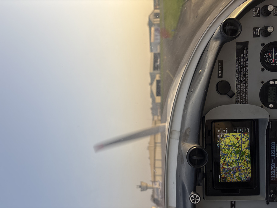
An interior view from the cockpit of a small aircraft captures a scene on a taxiway or runway at Toussus-le-Noble Airport (LFPN), Toussus-le-Noble, France. The ambient light suggests either sunrise or sunset, characterized by a warm, hazy glow near the horizon. In the foreground, the aircraft's gray dashboard is prominent. A mounted tablet-like device displays a detailed topographical navigation map, showing the time as 17:53. The screen indicates menu options such as "Zoom Out," "Zoom In," and "Direct To." To the right of the screen, a power outlet is labeled "ALIM. 12V DC," and a placard details aircraft operational specifications, including approval for VFR day/night operations, prohibition of flight in known icing conditions, and restrictions on aerobatic maneuvers. Below the main dashboard, a Garmin radio panel displays "120.750" as the active communication frequency and "123.500" as standby. Other instruments are partially visible, including one labeled "ALT FLORA" and a circular engine instrument with red markings. Through the windshield, the aircraft's propeller is visible in the midground, blurred, indicating the engine is operating. A paved taxiway or runway extends into the distance, bordered by green grass. A small pink marker post is present on the right side of the taxiway. The background features airport infrastructure, including a light-colored control tower with a cylindrical base and observation deck positioned to the left. Multiple hangars and other airport buildings, generally light-colored, are visible under a sky that transitions from light blue at the zenith to a warm, hazy yellow-orange near the horizon. No individuals are visible.
No transactions found